
The Hamina Fortress Trail
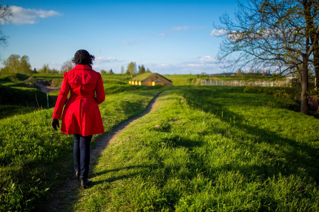
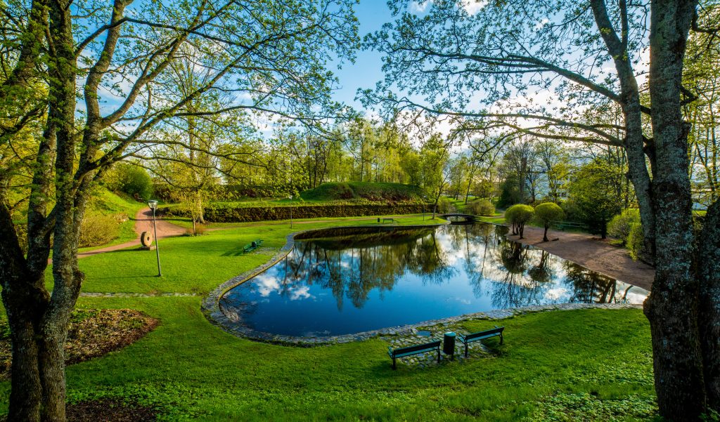
The Hamina Fortress Trail is a walking route that starts at the Flag Tower next to the Market Square and runs along the embankments of the Fortress of Hamina, ending at the Town Hall Square, the centre of the Fortress. You can walk the trail in either direction, and diverge from the trail along the route. The Fortress Trail is provided with seven information boards alongside this board. The QR codes on the boards offer further information on the past of the Fortress. The trail is about 4 km long and walkable year round.
Meet the moats that surround the Fortress, the gates that used to protect Hamina with drawbridges, and the impressive gun placements, tunnels and vaults – follow the trail and experience the history of the fortress bulwarks!
Download the map of the Hamina Fortress trail
Hamina Fortress Trail- video
Watch the video about the Hamina Fortress Trail, subtitles in English.
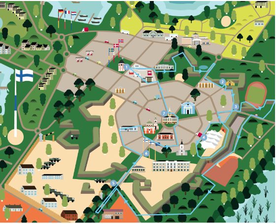
Fortress trail signs
- Flag Tower (Kaivokatu 6.): MEET THE HISTORY OF THE FORTRESS BULWARKS
- Hämeenlinna Bastion (Roopertinkatu 11) : GUNPOWDER AND ROMANCE
- Rauhankatu- street (Rauhankatu 8): WILDLIFE WITHIN THE EMBANKMENTS
- Central Bastion ( Raatihuoneenkatu 12) : MAGNIFICENT VAULTS OF HAMINA BASTION
- Vyborg gate (Kadettikoulunkatu 7) : HISTORIC MILITARY TOWN
- Reserve Officer School Park (Kadettikoulunkatu 6) : IMPRESSIVE MEETINGS IN THE STREETS AND ALLEYWAYS
- Town Hall Square (Raatihuoneentori 6) : BECOME ENCHANTED BY THE ATMOSPHERE OF THE TOWN HALL SQUARE